What’s a Report Card?
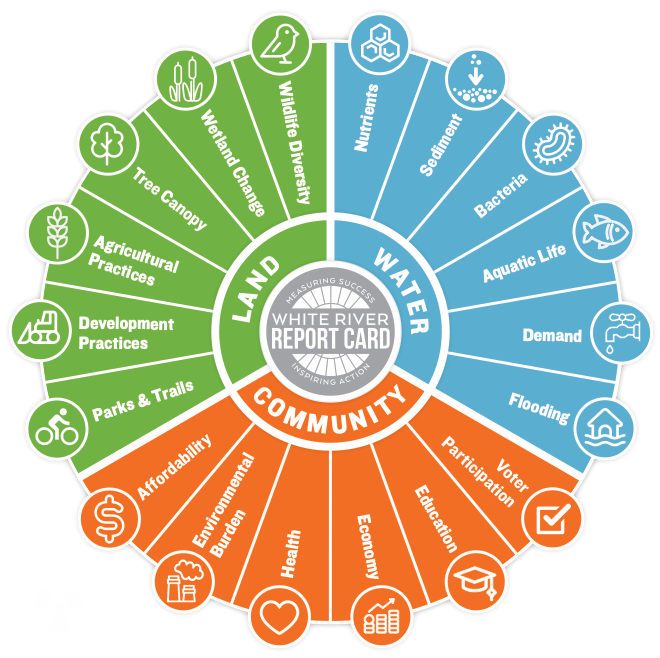
Just like the report cards of our youth, the White River Report Card is an assessment and communication tool that helps us understand how the river, and its relationship with the communities along it, is doing. Through a stakeholder engagement process, we selected things to measure (we call these indicators) that reflect the diverse values, interests, and uses of the river. These indicators are grouped into three categories: water, land, and community. Each indicator was judged against a goal, resulting in a grade.
While this is the first report card for the White River, it is modeled on similar initiatives for waterways across the world, including the Mississippi River, Chesapeake Bay, and the Gulf of Mexico here in the United States.
The Upper White River Watershed
Covering 2,752 square miles in 16 counties in Central and East Central Indiana, the White River watershed is home to millions of residents living in communities like Muncie, Anderson, Noblesville, Fishers, Carmel, Indianapolis, and Martinsville.
What’s a watershed? We’re glad you asked! A watershed is all the land that drains to a water body like the White River.
Who’s Involved?
Farmers, utility companies, environmental organizations, public health departments, economic development partners, regulatory agencies, elected officials, average residents–pretty much everyone that needs a healthy and resilient river should be part of the conversation. The White River Report Card is being developed by a diverse group of stakeholders with the support of these partnering organizations.

